A Context-enriched Satellite Imagery Dataset and an Approach for Parking Lot Detection
Abstract
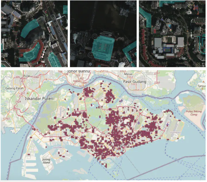
Automatic detection of geoinformation from satellite images has been a fundamental yet challenging problem, which aims to reduce the manual effort of human annotators in maintaining an up-to-date digital map. There are currently several high-resolution satellite imagery datasets that are publicly available. However, the associated ground-truth annotations are limited to road, building, and land use, while the annotations of other geographic objects or attributes are mostly not available. To bridge the gap, we present Grab-Pklot, the first high-resolution and context-enriched satellite imagery dataset for parking lot detection. Our dataset consists of 1344 satellite images with the ground-truth annotations of carparks in Singapore. Motivated by the observation that carparks are mostly co-appear with other geographic objects, we associate each satellite image in our dataset with the surrounding contextual information of road and building, given in the format of multi-channel images. As a side contribution, we present a fusion-based segmentation approach to demonstrate that the parking lot detection accuracy can be improved by modeling the correlations between parking lots and other geographic objects. Experiments on our dataset provide baseline results as well as new insights into the challenges and opportunities in parking lot detection from satellite images.
Video
Hu Wenmiao
Ph.D. candidate & Ph.D. Researcher
Ph.D. National University of Singapore (2024), Ph.D. researcher at Grab, Grab NUS AI Lab.